Page Updated:- Wednesday, 24 June, 2026. |
|||||
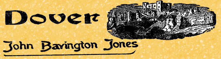 Published in the Dover Express, 30 November, 1979. A PERAMBULATION OF THE TOWN, PORT AND FORTRESS. PART 38.
It is probable, however, that both New Street and York Street had been in existence since AD 1131, when the foundations of the Priory of St Martin were laid, and that this lane, under the town wall, was in direct connection with the King's highway, which a Priory deed of 1273 said “leads from Dover Priory as far as Stappingdune" (i.e. Stepping Down). "Turne-againe Lane" was apparently a new designation in 1540, for it is only mentioned on the endorse, and not in the body of the deed. The whole route, no doubt, was originally called Priory Lane, as it was the only way from the gate of the town to the Priory, and along this must have been carried the materials, Including a large quantity of Caen stone, imported from Normandy to build the church and other monastery edifices. There are now other cross roads from Biggin Street in the direction of the Priory, but they are all of later date.
NEW STREET. New Street, no doubt, took its present name when, by the building of houses, the old lane became a new street. That would be about 1785, when the New Folkestone Road was made. Priory Lane, which was then called the "Back Ditch," had its name changed to York Street about the same time in honour of the Yorkes, Philip and Charles, who, up to a few years previous, had for about fifty years been Recorders of Dover. It was not difficult, before recent demolition of property in the area, to identify the part of New Street which was built when it received its name some 200 years ago. Those small houses on the south side, built with very hard red bricks, in some cases combined with stones from the town wall, formed the original part of New Street; and the houses on the east side of York Street, built with the same sort of brick, were of about the same date. These red bricks were to be traced in other parts of the town, and invariably in buildings of the close of the 18th century. The north side of New Street was built at a much later period. New Street, when it was new, was a very respectable Dover suburb, overlooking the Priory Meadows. The meadows have been transformed to streets, and New Street itself became densely populated, not only on each side of the thoroughfare, but in adjoining squalid courts, which, happily, have long since disappeared. For many years New Street had two public houses, the oldest, the "Prince of Orange," the other, the "Eight Bells," which was in existence fifty or sixty years. No doubt the name of the latter referred to the bells in St Mary's steeple, nearby. It was de-licensed in 1911.
QUEEN’S GARDENS. Queen's Gardens in the reign of Queen Elizabeth I was a part of the Maison Dieu property and from Queen Elizabeth the name was derived. About the time of the Restoration it was held by the Kennetts, being an acre in area and used as a garden. It was transformed into a street at the beginning of the 19th century. It was a pleasant open place when New Street was built. It is a curious fact that in early times, when land was cheap and plentiful, builders constructed houses flush with the street, as seen in the building done on the east side of York Street 120 years ago; while the houses on the west side, erected 50 years later, by which time building land had appreciated, had neat, little forecourts with flower beds placed between the houses and the street. The houses on the east side, however, when new, had the advantage of pleasant backs looking out on Queen's Gardens, which then did not consist of bricks and mortar, but were rural gardens belonging to Gunman's mansion, and kept up more for pleasure than profit. Queen's Gardens as a street is much more modern than New Street and York Street. Concerning Queen’s Gardens as a street, there is not much more to record. It has been a street since about 1800 and there has not been much change, except that improvements of 1894 let light and air in at both ends. The southern end approached New Street through a narrow covered passage beside John Tickner's bakehouse, in the midst of an environment socially and sanitarily unsalutary; while the northern end, opening into Worthington Lane, was rendered unsavoury by the odour of stables, dung-heaps, and animal slaughter. Except at the ends, the street was wide and fair, containing, in the 1820s, an admixture of stores, workshops and dwellings. A similar mixture still occupies Queen's Gardens, though a large space on the eastern side was later occupied by the rear of the old King’s Hall cinema — now a bingo club — which was built in 1908.
YORK STREET. York Street, originally named Priory Lane, was called Back Ditch owing to its being the course of an intermittent stream which carried off the storm water from the Western Heights, and the surface drainage (there was no other), from the houses between it and Cowgate. It seems to have been called “Back Ditch“ as long ago as 1606, there being an entry in the Almshouse accounts of that year as follows: “For a wyndinge sheet for the Spaniard buried at Back Ditch 1s. 10d., and for carrying him to be buried 12d.“ In later years, before the main drainage of the town was constructed, the street was, in derision, called Black Ditch because of the filth that ran down it, the usual custom being to pump the sewage from cesspools at the rear of those red brick houses, and allow it to run down the street to Worthington Lane, and so find its way into the river.
|
|||||
|
If anyone should have any a better picture than any on this page, or think I should add one they have, please email me at the following address:-
|
|||||
| LAST PAGE |
|
MENU PAGE |
|
NEXT PAGE | |